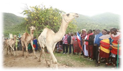
Samburu(025)
Samburu County is a county in the former Rift Valley Province, Kenya. It covers an area of roughly 21,000 km2 (8,000 mi2) in northern Kenya where the Samburu, Turkana and many other tribes live. It stretches north from the Wuaso Ng'iro River to the south of Lake Turkana. According to the 2019 census, the county has a population of 310,327.
Within Samburu County are the towns of Maralal (capital and largest town),Baragoi, Archers Post, South Horr, Wamba, Lodosoit, and Kisima.
It also includes the Samburu National Reserve, Bisanadi National Reserve, and Buffalo Springs National Reserve, Mount Ng'iro, Ndoro Mountains, Mathews Range (Ol Doinyo Lenkiyo), Kirisia Hills, and Loroki Forest.
The main access road to Samburu County is the A4 road from Rumuruti-Maralal-Baragoi, which as of 2019 was being tarmaced from Rumuruti up to Maralal.
There is a town named Samburu in Kwale County also in Kenya, but it is not related to Samburu County or Samburu people.


